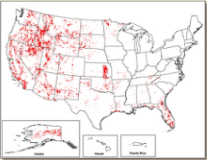
 The burned area boundaries dataset is a vector polygon ESRI shapefile of the extent of the burned areas of all currently completed MTBS fires for the continental United States, Alaska, Hawaii and Puerto Rico.
File Format: ESRI shapefile
File name: mtbs_perimeter_data.zip